![[Americana] [Northwest Territory] Land Ordinance of 1785
[Americana] [Northwest Territory] Land Ordinance of 1785](https://auctiondaily.com/wp-content/uploads/2022/01/10945511.webp)
![[Americana] [Northwest Territory] Land Ordinance of 1785
[Americana] [Northwest Territory] Land Ordinance of 1785](https://auctiondaily.com/wp-content/uploads/2022/01/10945512.webp)

![[Americana] [Northwest Territory] Land Ordinance of 1785
[Americana] [Northwest Territory] Land Ordinance of 1785](https://auctiondaily.com/wp-content/uploads/2022/01/10945511-150x150.webp)
![[Americana] [Northwest Territory] Land Ordinance of 1785
[Americana] [Northwest Territory] Land Ordinance of 1785](https://auctiondaily.com/wp-content/uploads/2022/01/10945512-150x150.webp)
[Americana] [Northwest Territory] Land Ordinance of 1785
Winning Bid: $201,600
[Americana] [Northwest Territory] Land Ordinance of 1785:
A rare printing establishing America’s public land system, and the mechanism for surveying and selling land in the Western Frontier
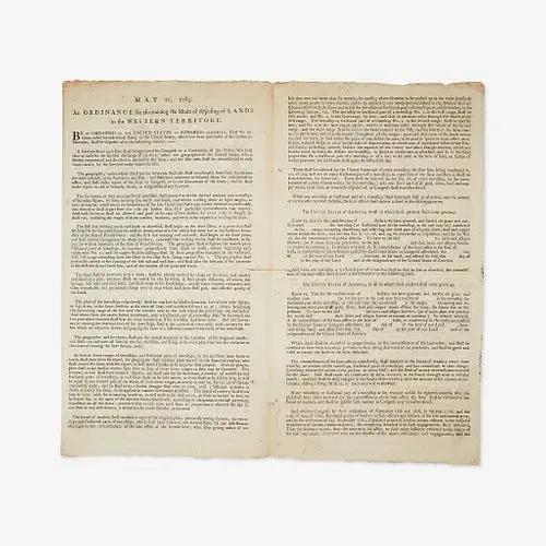
“BE IT ORDAINED BY THE UNITED STATES IN CONGRESS ASSEMBLED, That the territory ceded by the individual states, to the United States, which has been purchased of the Indian inhabitants, shall be disposed of in the following manner…”
(New York, 1785). 4 pp. Bifolium sheet, 14 1/4 x 8 in. (362 x 203 mm). Printed Confederation Congress ordinance, being “May 20, 1785, An Ordinance for ascertaining the Mode of Disposing of LANDS in the Western Territory” on second through fourth pages, and with Land Ordinance of 1784 of April 23, 1784, printed in full on first page. Signed in type on page four by President of the Congress of the Confederation, Richard Henry Lee, and Secretary Charles Thomson. Fore-edge trimmed; horizontal crease from original fold, 1 3/4 in. separation traversing center of same; contemporary docketing below Lee’s signature on fourth page: “Act 23rd April 1784/for temporary government/of western territory–Ordinance for dispo-/sing of western terry/May 20th 1785”; spotting in top margin; a few scattered spots. Evans 19283; ESTC W38445
An extremely rare printing of the Land Ordinance of 1785, adopted by the United States Congress of the Confederation on May 20, 1785, one of the most significant pieces of congressional legislation and the prelude to the historic Northwest Ordinance of 1787. This landmark document set up a standardized system for the government to measure, divide, and facilitate the selling to settlers, undeveloped land in the Northwest Territory acquired from Great Britain at the end of the American Revolution (current day Ohio, Indiana, Illinois, Michigan, Wisconsin, and the northeastern part of Minnesota). The Ordinance laid the foundation for government land policy, established the basis for the Public Land Survey System, and set the stage for organized westward expansion. It was largely an extension of the Ordinance of 1784, written by Thomas Jefferson, and debated in a committee comprised of Jefferson, Hugh Williamson, David Howell, Elbridge Gerry, and Jacob Read, and passed by Congress on April 23, 1784. The 1784 Ordinance called for the development of land north of the Ohio River, its division into separate states, and the means for establishing a temporary government (printed on the first page of this document). Among the chief purposes of these Ordinances was to address Congress’s need to raise much needed revenue for the government (due to its inability to levy taxes) by selling public land recently ceded to it by the individual states.
“The land Ordinance of 1784 was never implemented before it was superseded by the Ordinance of 1785. The latter was primarily designed to raise revenue toward payment of the public debt by selling land in the Old Northwest as soon as the Indians relinquished their claims and it was surveyed…The Ordinance of 1785 served as the primary legislation for a public land system. It called for a survey with a base line beginning at the point where the Ohio River intersected the western boundary of Pennsylvania and extending west for seven ranges (42 miles) and then south. Townships six miles square were made up of thirty-six sections, each one mile square (640 acres). Three sections of each township were reserved for public school use, another section for religious use, and other lands reserved for Continental officers, Canadian refugees, Virginia soldiers, and Christian Indians per agreement with Virginia. The land was to be sold at public auctions for not less than one dollar an acre, and certificates of pay to Revolutionary veterans would be acceptable at face value. Still needed was a process by which government would be established over this territory.” (Liberty’s Legacy: Our Celebration of the Northwest Ordinance and the United States Constitution, 1987, p. 31)
The 1785 Ordinance was debated in a committee established in March of that year, and comprised of one representative from each state. For a month, the committee, largely led by William Grayson of Virginia and Rufus King of Massachusetts, debated the ways to implement a standardized and fair system to survey and sell land that was acceptable to both Northern and Southern members of Congress. Both wanted to find a way to expand the Union without threatening their own states sovereignty. The committee’s decision to divide the land into a grid-like system of townships largely reflected the influence of the New England system of town planning, which saw the colony, town, or proprietor first survey the land into measured tracts to then be sold. Compared to this was the less ordered Southern system, which was largely a decentralized and individual initiative based around the idea of a farm and that saw buyers choose the swaths of land they desired first, followed by an official survey, and then purchase. This “metes and bounds” system typically relied on natural markers in the landscape that changed over time, and often led to boundary disputes, inimical to an orderly selling of federal land. In April, a report of the committee was read before Congress, and in the following month compromises were made, including the reduction of the size of townships from seven to six miles square. Importantly, the final draft of the Ordinance included a section requiring the proceeds of center lot 16 of each township be designated for the maintenance of a public school, as education was seen as essential for the permanency of the Union.
The initial land surveys were completed by Thomas Hutchins, Geographer of the United States (later called Surveyor-General), and others, in the Seven Ranges region in Eastern Ohio. Philadelphia scientist David Rittenhouse, and Col. Andrew Porter, established the first survey line at the Pennsylvania and Ohio borders. Public land auctions of some of the territory began in New York in 1787.
The Confederation government increasingly came up against problems when trying to put this Ordinance into motion: indigenous populations fighting to retain their land and hunting grounds from encroaching Americans, external pressure from Great Britain and Spain who meddled on the periphery of the territory and destabilized the region, and the Confederation’s general lack of power and resources to both raise a military to protect its settlers and establish control of the region. While the passage of the Northwest Ordinance in 1787 established a framework for government for the Northwest Territory, and outlined the mechanism for territories to enter the Union, it wasn’t until the Constitution was adopted the following year that the federal government was given the power to both enforce and put this Ordinance into true effect.
According to the Houghton Library at Harvard University, there are two printings of this document, one with and one without Secretary to the Confederation Congress, Charles Thomson’s printed signature. The National Archives has two copies, one with Thomson’s autograph signature in place of a printed one (LCC 90898211), and one without any signature (1943531). We have also located a Hartford, Connecticut printing by Hudson and Goodwin. That edition, with Thomson’s printed signature, was likely printed sometime after this edition.
We cannot locate any copies of any of these 1785 Ordinances ever being offered at auction.

